
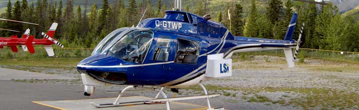
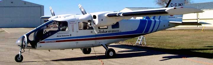
The MATRIX LiDAR system is the fifth generation airborne LiDAR survey system designed and manufactured by LSI engineers. The MATRIX system encompasses many aspects of new sensor technology integrated with proven field operational techniques and knowledge for the collection of high quality LiDAR data. The MATRIX system also supports high resolution downward and forward looking digital cameras as well as an oblique view digital video camera. For all MATRIX LiDAR systems LSI uses Riegl lasers due their ease of integration, high reliability and their rugged design. LSI has successfully completed many airborne LiDAR surveys in some of the world’s more difficult environments from the Andes Mountains in Ecuador to the Jungles of Malaysia and Indonesia.
Call Toll-Free
1-888-870-9972


Technology Overview
What is LiDAR?
The term LiDAR is an acronym for Light Detection And Ranging. LiDAR is an active remote sensing system that incorporates a laser scanner, GPS, and Inertial Measurement Unit (IMU) and can be further integrated with high resolution digital cameras and video.
LiDAR has been adopted by many industry sectors to respond to the growing need for rapid, cost effective and accurate geospatial information. LiDAR can be used in conjunction with traditional imagery for orthorectification, but can also stand alone for vertical 3-D surface modeling. The application and requirements for this technology are as varied as the clients’ industry, experience and imagination.
LiDAR is a tool that offers
- Rapid delivery of x, y, z terrain data
- High accuracy full feature and bare earth models, even under canopy
Project Applications
Power Line Transmission Corridors
- Non-intrusive new route surveys
- Geospatial inventory acquisition
- Terrain elevation model
- Line maintenance vegetation encroachment and danger trees
- Transmission line thermal rating
Floodplain Mapping and Dam Safety
- Bare earth surface modeling
- High-risk flood zone determination
- Evacuation route planning
- Diversionary remediation planning
- Flood plain maps
- Reservoir LiDAR mapping
- GIS mapping
Mining
- Vegetation canopy and bare earth modeling, 3D Maps, ASCII x, y, z data sets
- Mine site digital elevation model (DEM)
- Hill shade relief maps
- Contour overlay, slope analysis
- Full project life cycle planning using LiDAR derived bare earth models from exploration to remediation
Oil & Gas Exploration
- Topographic map
- Environmental modeling
Other Applications
- Georeferencing
- Fault line maps
- Terrain elevation map
Matrix Technology
LSI has been involved in a wide variety of projects that span two decades and five continents. The need to customize or adapt specialized sensors for each project has been a prime goal. LSI’s fifth generation and latest LiDAR system, MATRIX, addresses these needs by incorporating a modular approach to both the hardware and software used in the data acquisition phase. The appropriate sensors are mounted into a helicopter or aircraft and the data streams are time correlated with high accuracy to GPS time, position and aircraft attitude. This essentially produces a three-dimensional database for any sensor installed for the data collection. The typical hardware configuration of the MATRIX system includes a Digital Waveform scanning laser, an Inertial Measurement Unit for real time attitude determination, and a downward pointing high resolution digital camera for surface feature mapping and generation of orthorectified images. Additional sensors can be interfaced with MATRIX on an as needed basis to meet the client’s required data collection requirements.
LSI Services
LSI’s success in a wide range of industry applications owes itself to the fully-customizable nature of its MATRIX LiDAR systems. Each project comes with its own challenges, requirements, and specifications, resulting in a cost effective, custom tailored solution for each project. To maximize the effectiveness of these enhanced services, LSI has established relationships in many industries beyond simple mapping services, providing our clients with access to additional insight into their specific industry and enhanced relevant processing techniques. LSI is currently active in full-waveform laser scanning technology.
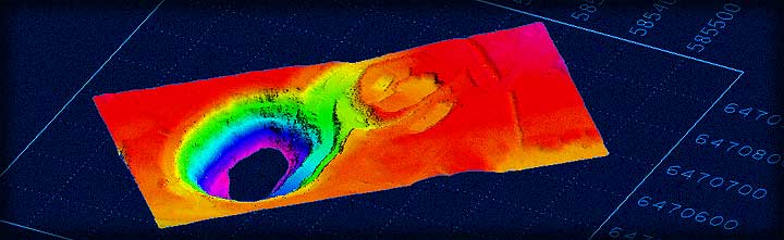
Residual Elevation Attribute applied to LiDAR data
A Novel Application of LiDAR Data for Surface Geologic Studies
A topographic surface evolves from a number of processes including, but not limited to, geologic factors. Topographic features such as outcrops, faults, etc., provide direct evidence of the underlying geologic structures.
LiDAR terrain models contain a great deal of information, including the elevation of these topographic features. However, if the irregularities related to these features have very small vertical changes, they are unlikely to become visible using currently available software.